Home / Routes

Routes

Discover the routes and trails of the region, views, viewpoints, and outdoor adventure in nature

Nature and Routes (Adventure Peaks)

The hiking paradise just around the corner! Camaleño is your gateway to the heart of the National park of Picos de Europa. Get ready to breathe fresh air and enjoy beautiful landscapes that will leave you without breath.

Forest and villages with charm

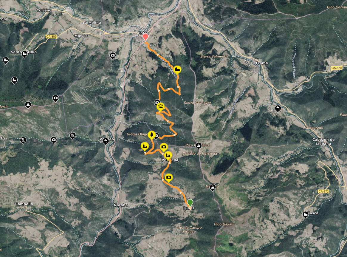
POTS - ATTITUDES

General information

Route joins Pots with the people of Attitudes through traditional paths and wooded areas of the valley.

The tour starts at the Bridge of San Cayetano, in the historic old town of Potes. After the bridge, turn right into the street Source The Water, climb the stairs at the end of the road and across the road is the start of the trail.

YOU SHOULD KNOW

Distance: 14 km approx. (back and forth)
Approximate duration: 5 – 6 hours
Type of tour: Linear (back and forth)
Difficulty: Average

The trail ascends gradually from forest to pass by Porcieda, an ancient people today abandoned located in the middle of the mount. From there, it continues until you get to Attitudes, where it is possible to make a stop before returning.

The return is by the same route.

Ascension with views over Pots

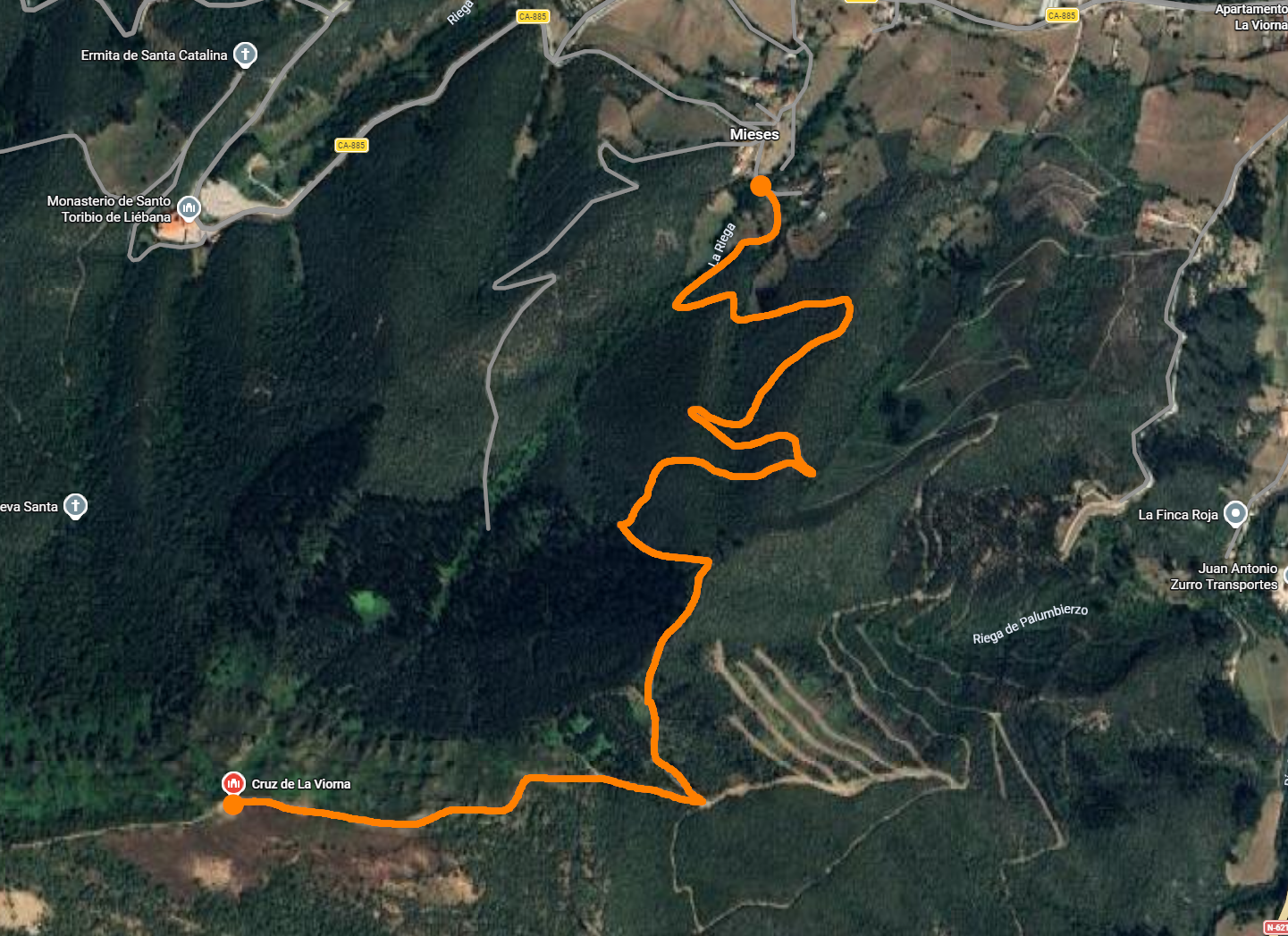
CROSS OF THE VIORNA

General information

Route of ascent to the Cross of the Viorna, visible from Pots and it is easily recognizable by its nocturnal illumination.

It is a upload demanding but very rewardingwith spacious views over the valley and the surrounding area during the tour. It is a good option when you have half a day and looking for a route short but intense.

YOU SHOULD KNOW

Distance: 10 km (round trip)
Approximate duration: 2 h 30 min
Elevation: 720 m
Type of tour: Linear (back and forth)
Difficulty: Medium – High

The itinerary begins in Cerealsfrom the last house in the neighborhood above the village, the path ascends continuously until you reach the cross situated on the top.

The return by the same path.

Familiar path under the Peaks

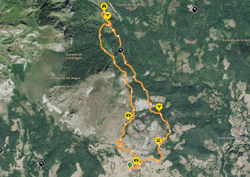
CHANNEL ARRENDORAS - BREZ

General information

Circular walk from the village of Brez that runs under the eastern massif of the Picos de Europa.

It is a very comprehensive route and accessible, with stretches of open and shaded areas, perfect as a first contact with the environment or for the whole family. During the tour you can enjoy sweeping views of the landscape lebaniego and several summits emblematic of the area.

YOU SHOULD KNOW

Distance: 7,04 km
Approximate duration: 3 h 30 min
Elevation: 315 m
Type of tour: Circular
Difficulty: Easy – Medium

The route progresses through old tracks used for access to the mines of the Arredondas until you reach the Prao The Most, the start of the channel. The return is made by a parallel runway that leads back to Brez.

Descent with a panoramic view high mountain

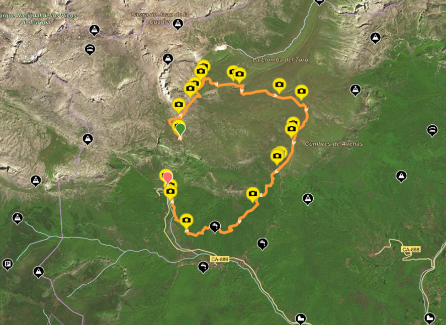
THE CABLE FUENTE DÉ (PR-24)

General information

The marked route that connects the upper station of the cable car Fuente Dé with the valley through a comfortable ride in downhill.

YOU SHOULD KNOW

Distance: 15 km
Approximate duration: 5 hours
Elevation: 150 m (descent)
Type of tour: Linear
Difficulty: Easy – Medium

The itinerary starts in The Cable, point, which is accessed by cable car, and gradually descends to Fuente Dé. During the hike you go through wide meadows high mountain in the Ports are Alive, with open views between the massifs of Central and Eastern Picos de Europa.

As we lost altitude, the landscape changes into wooded areas and trails are more protected until you return to the starting point. It is a long route but affordable, ideal to enjoy the variety of landscapes without great technical effort.

Classic route of the high mountain

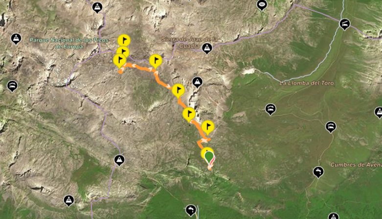
COTTAGE VERONICA AND FORKS RED

General information

Route of the high mountain that starts from the top station of the cable car Fuente Dé to the shelter of Cabaña Verónica, located 2.325 meters of altitude.


The tour moves through open terrain of the mountain, passing through areas with stones and sweeping landscapes of the massif central Picos de Europa. The trail is well marked and it is evident, although the absence of shade and the presence of loose gravel, making it necessary to go well equipped.

YOU SHOULD KNOW

Distance: 12 km (round trip)
Approximate duration: 4 hours
Elevation: 698 m
Type of tour: Linear (back and forth)
Difficulty: High

From Cabaña Verónica you can continue up the hill of Red Forks, a spectacular natural viewpoint with views towards Pico Urriellu (Naranjo de Bulnes). The return is by the same route.


The shelter, built from the structure of an old aircraft carrier, is one of the most unique spots of the park.

Ascension demanding and panoramic

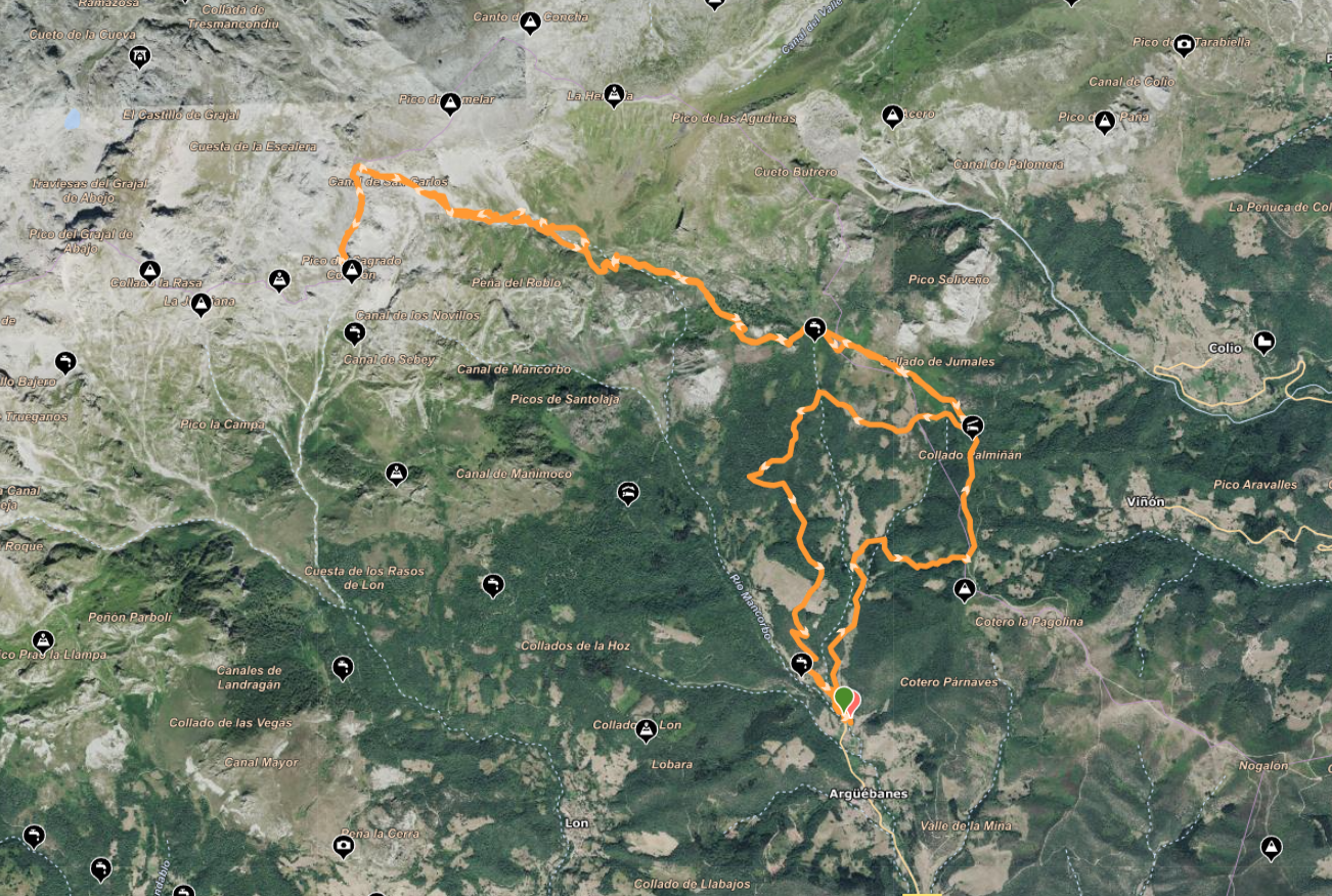
PEAK SAN CARLOS

General information

Route of the high mountain that rises to the Peak San Carlos, also known as Peak Sacred Heart, visible from a large part of the valley of Liébana.

YOU SHOULD KNOW

Distance: 20 km approx.
Approximate duration: 8 hours
Elevation: 1.047 m
Type of tour: Linear (back and forth)
Difficulty: High

The route begins in the village of Argüébanes and rises continuously for mountain terrain to reach the top. It is a long route and with a strong vertical drop, which is recommended for hikers that are accustomed to demanding walks.


The effort is rewarded with panoramic views over the Picos de Europa and the environment lebaniego, making it one of the ascents most comprehensive in the area.

Historic mine road mountain

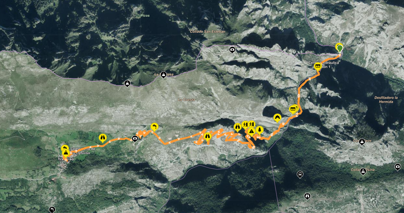
PATH URDÓN TO TRESVISO

General information

Classic mountain route that connects Urdón with the people of Tresviso through the historical Path of the Rock, the ancient via mining open in the NINETEENTH century

YOU SHOULD KNOW

Distance: 12 km approx. (back and forth)
Approximate duration: 4 hours
Elevation: 850 m
Type of tour: Linear (back and forth)
Difficulty: Medium – High

The tour begins in Urdón, within the Gorge of la Hermidaand ascends through a well-defined path that gains altitude progressively over the ravine of the river Urdón. The climb is done through numerous switchbacks with breathtaking views throughout the journey.


A path is physically demanding due to its height, continuous, although without technical difficulty, or possible loss of the way. When you get to Tresviso, it is worth visiting the village and make a stop before you start the return by the same route.

PATH UNDER THE PEAKS

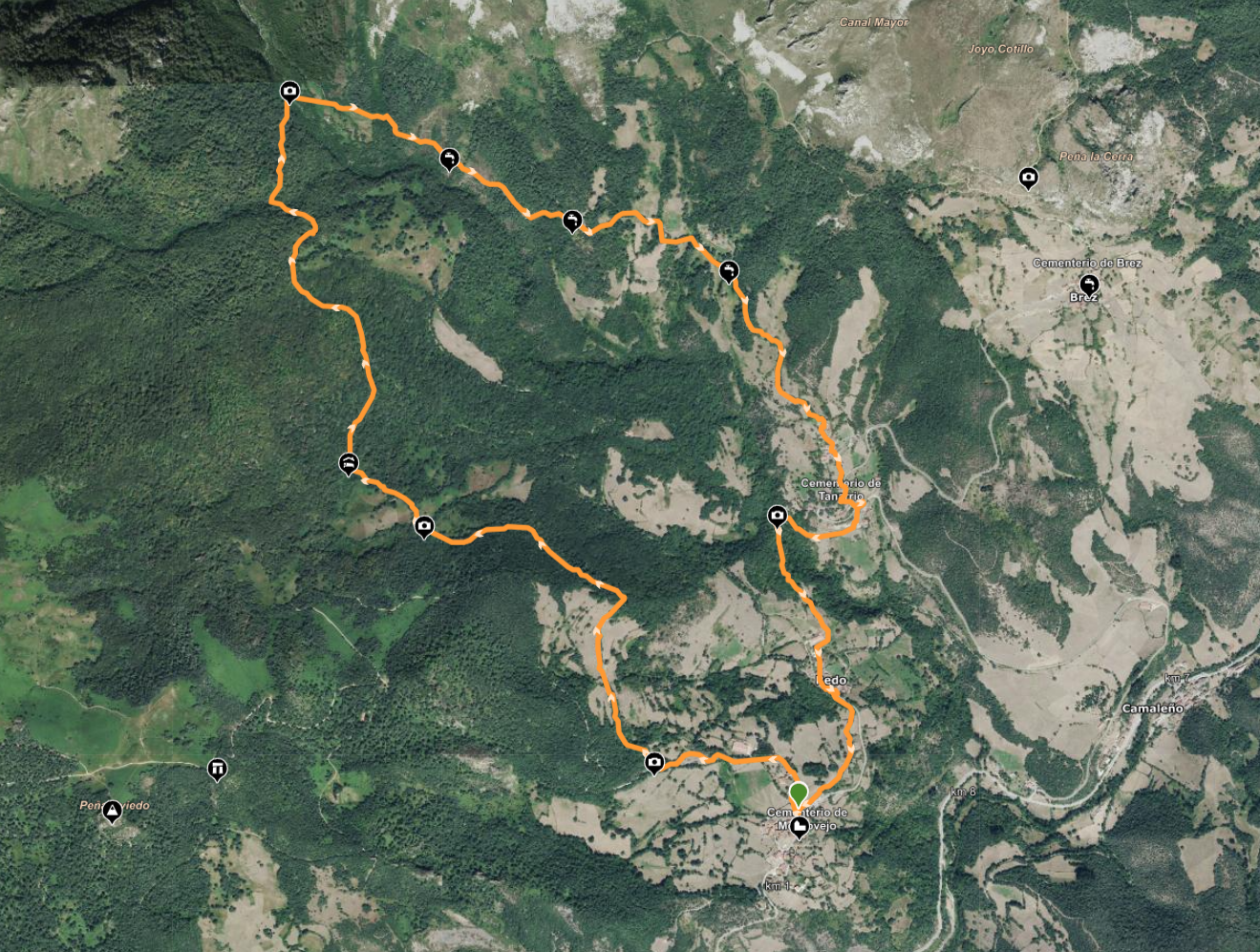
PATH UNDER SURGES IN MOGROVEJO

General information

The people of Mogrovejo, located between Potes and Fuente Dé, is one of the most beautiful villages of Spain with easy access. From here there is a circular route that goes through the lower part of the Eastern Massif of the Picos de Europa, crossing traditional paths and forest trails with excellent views of the environment.

This is a simple itinerary and pleasant, ideal to enjoy the scenery without huge physical demands and perfect for the whole family

YOU SHOULD KNOW

Time: 3 hours
Distance: 9 km approx.
Elevation: 310 m
Type: Circular

The route starts next to the medieval tower of Mogrovejo, and it is marked throughout the route, so there is no loss.

The path continues towards Tanarrio, descends to the low neighborhood and continues towards a source located to the right. After passing through a farm with two hatches and cross a small bridge to reach the town of Redo, from where it returns to Mogrovejo by road or by a old way slightly elevated.

It is advisable to bring appropriate footwear, water, and sun protection, especially in the summer months.

For any doubt or query, do not hesitate ne contact with us

  • Email: marisolfbriz@hotmail.com

  • Phone / WhatsApp: +34 660 79 75 49 (you Can click here to start a conversation: WHATSAPP)

  • Instagram: @home.the ribera

Where you can find us?

To get to our house in Peaks of Europe, from Pots, follow the road to Fuente Dé until you reach the turnoff to the height of the town of San Pelayo (to the right). Follow the detour ends in the village of Lon.
THE WATERFRONT COTTAGE
Address: Lon, Camaleño, 39587, Cantabria
Coordinates: Latitude 43.169351934563 – Length -4.682305045299